 |
|
|
Nederlands
| MAND atlas
↓ cartography
| GTRP transcriptions
Cartography: Kloeke
more Cartography: applications | typology | importance | historical | linksCentral to all cartography at the Meertens Instituut is the "Kloeke-tabel".
|
Meer in nieuw venster: practice (Dutch) validation (Dutch; ppt) Kloeke and Grootaers motivation of Kloeke (Dutch) design process 1926 (by Kloeke; Dutch) map fragment 1926 map title 1926 introduction Register 1934 reaction Kloeke 1938 introduction Register 1962 memo 1997 adaptations 2002 top |
||
top
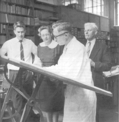
Gesinus KloekeDr. Gesinus G. Kloeke is unique in his effort to standardize linguistic cartography. In cooperation with dr. L. Grootaers from Louvain for the southern parts of the Dutch language area Kloeke designed a base map and a register of codings, in everyday usage called 'Kloeke-tabel'.
Kloeke made a plea for the national institute of dialect research (at the time in process of establishment) to take over the map and administer the register.
|
validation (Dutch; ppt) Kloeke and Grootaers motivation of Kloeke (Dutch) design process 1926 (by Kloeke; Dutch) top |
||
DigitalTogether with the rise of computerization an attempt was made to digitize the Kloeke map and register. Following a series of maps of a first generation digitized map (by the "Topografische Dienst") a second generation map has been the basis of more recent maps of the Meertens Instituut. Dr E. Wattel and dr P. van Reenen based themselves on the CIA-Worldmap to design a new ground map to which they linked the 'Kloeketables' by means of an electronic pen.For demands of digital disambiguity all numbers were re-coded into codes of five characters each while replacing some confusing sub-specifications. |
first version example second version: memo 1997 adaptations 2002 top |
||
Current practiceRegarding current cartographic practices at the Meertens Institute:
top |
|
||
Data matchingIt goes without saying that by means of geographical coordinates your data can be linked up to other databases within other national and international geographical information systems. One example has been incorporated into the user friendly "Kloeketabel"-application where Kloeke-codes and zip codes are teemed together introducing options for data comparisons using collections based on zip codes.The already mentioned "Kloeketabel"-application contains several base maps of a variety of themes for the purpose of speculating on extra-linguistic relationships. |
on coordinates (in memo 1997) postcodes Corop top |
||
External practiceRegarding cartographic practices outside of the Meertens Institute: almost all collections within dialectology and ethnology use Kloekecodes to pinpoint the recordings and observations.The MapInfo-application as developed at the institute is put to use also for production of maps for, among others, the Brabantic and Limburgian thematic dictionaries at Nijmegen and Ghent.
|
Regional Dictionaries (ReWo) ReWo-examples top |
||
|
The licence free application for generating HTML-based maps is in process of adaptation for use (at recent request) in other European countries. The app will then allow for import of new coordinates and names.
Please, also note the JavaScript application at → GTRP transcriptions.
|
applications (this window)
contact |
||
|
Dialect cartography, until recently, usually took place on a blank base map with Kloekecodes in smallprint or with help of a private sketch.
|
kaartschets |
||
|
A privately developed application for pre-print preparation of Kloeke-maps is the Latex-gebaseerde program Carto. The symbolization on a blank Kloeke-map is done by hand. Symbols of the same kind may be changed in one go. The resulting map is purely graphica, not inter-active and does not contain any kind of database.
|
Carto Carto-example top |
more Cartography: applications | typology | importance | historical | links
Nederlands
| MAND atlas
↑ cartography
| GTRP transcriptions